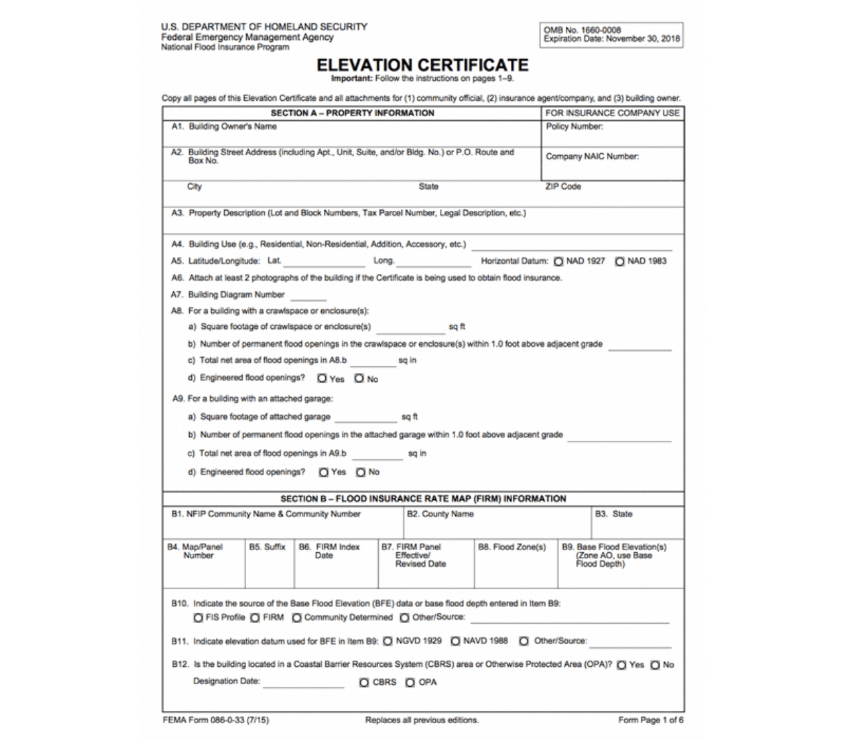
What is an Elevation Certificate?
An elevation certificate (EC) is an important tool used to document and approve your home’s elevation relative to the estimated level floodwaters could reach if a major flood occurred in a high-risk area. In addition, ECs are used by the NFIP to give elevation information needed to:
- Determine the accurate insurance premium
- Confirm compliance with community floodplain management ordinances
- Support a request for a Letter of Map Amendment (LOMA) or a Letter of Map Amendment based on fill (LOMR-F)
Who Needs an Elevation Certificate?
In high-risk areas, there is at least a one in four chance of flooding during a 30-year mortgage. Therefore, for certain buildings in a high-risk flood zone, an EC may be required if the flood insurance policy is written through a federally regulated insurance lender (such as the NFIP). However, if you write your policy through a private carrier, they do not typically require ECs for any zone.
ECs are not required and are not used for flood zone rating in moderate- to low-risk areas (Zones B, C and X), undetermined risk areas (Zone D), or certain high-risk areas eligible for other subsidies (e.g., Zones AR and A99). New Jersey Flood Insurance can assist with determining or verifying your flood zone, as well as help identify possible lower premiums based on the latest map changes.


When Do You Need an Elevation Certificate?
When you are buying a new home in a high-risk area, are looking for better rate options, or there has been a recent flood zone change in you community – you will more than likely need a copy of your EC.
In high-risk flood zones, NFIP policies cannot be written without the EC for the property or home. Though most private carriers may not require an EC to issue a policy, not every home will qualify for private coverage. Therefore, when you contact New Jersey Flood Insurance (or any insurance agent) to purchase flood insurance and you live in a high-risk area, having a copy of your EC ready is suggested.
Where to Get a Copy of
Your Elevation Certificate?
There are a number of ways to obtain a copy of your EC, including:
- Developer or Builder.
In a high-risk area, the developer or builder may have been required to have an EC at the time they began building. - Sellers of the Building.
When purchasing a new home, request that the sellers provide a copy of the EC for the property – especially if the home is in a high-risk zone. If they don’t have an EC, ask if one can be provided before the closing. - Floodplain Managers.
Every NFIP participating community has a floodplain manager and therefore, one might already be on file. - Property Deed.
Occasionally the EC is included with this paperwork. - Hire a licensed land surveyor, engineer, or architect.
The surveyors’ duty is to define the elevation around the building areas on the property and to certify whether or not the area in question is under or above the prescribed flood elevation. Keep in mind, there is a cost associated when you hire a professional to complete an EC on your behalf. As a precaution, ensure the one you hire is authorized by law to certify elevation information.


How and Why is Your
Elevation Certificate Used?
Your insurance agent will use the EC to compare your building’s elevation to the Base Flood Elevation (BFE). The BFE is the elevation that floodwaters are estimated to have a one percent chance of reaching or exceeding in a given year. The higher your lowest floor is above the BFE, the lower the risk of flooding. Lower risk typically means a lower flood insurance premium.
If your building is in a high-risk area (Zones A or V), the EC includes essential information that is required for determining a risk-based premium for a flood insurance policy. For example, the EC shows the building location, lowest floor elevation, building features, and flood zone.
Sample Elevation Certificate
Below is a sample elevation certificate and some of the information
Alabama Flood Insurance will need to write your flood insurance policy.
Click Here for a Full Screen Preview>>


